Tour route map
Explore the stops along this journey. Zoom with your mouse wheel or pinch on a touchscreen; tap markers for place names.
The red line connects the itinerary days. Verified road sections follow mapped roads and paths; when routing is unavailable, the connection is schematic and not suitable for navigation. Routing powered by Mapbox ↗
Photos from this journey
Pamirs in 7 Days with total distance of 1650 km.
Dushanbe – Khorog – Wakhan – Murghab – Karakul – Osh through Wakhan Corridor
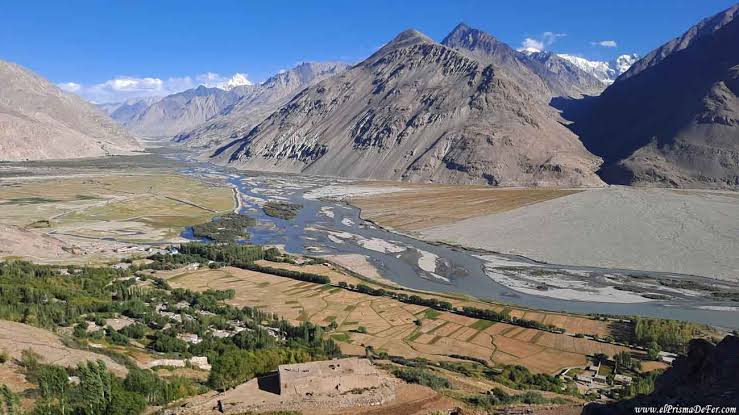
What you will see: Panj River and its gorges, along the Afghan border / The famous Wakhan
valley /Ancient fortresses Kah-Kaha and Yamchun (III-I century BC), / Petroglyphs / Yashilkul fantastic scenery / the Pamir plateau
What you will enjoy: Historical places / bathing in hot springs / amazing scenery of the Afghan
Hindu-Kush / Pamiri hospitality /possibility of seeing ducks and Indian goose (Anser Indicus) in their natural habitat.
Altitudes above sea level during the day: beginning of day – 780 in Dushanbe, highest point – 2126 m on Shurobod pass, end of day – 1295m in Kalai-khumb.
Your itinerary
Kalai-Khumb – Khorog. 280km 8-10 hours of driving, the road is not so good.
Khorog City Tour: Botanical Garden, Historical Museum, City Park and Visit Tourism Information Center.
Overnight in a hotel or homestay in Khorog. 250 km.
Altitudes above sea level during the day: beginning of day – 1295m in Kalaikhumb, end of the day – 2100m in Khorog.
Khorog – Wakhan Corridor/Zong. 246km 10-12 hours of driving.
Yamchun fortresses, Bibi Fotima hot-spring, pre-Islamic shrines, Museum of Sufi Muboraki Wakhoni, astronomer and scholar of the 19 th century and if there enough time go for trekking to Langar petroglyphs. Overnight in a homestay in Langar or Zong village.
Altitudes above sea level during the day: beginning of day – 2100m in Khorog, highest point –Yamchun 3200m, end of day – Langar 3000m.
Zong (Wakhan)–Bulunkul/Yashikul lakes–Alichur-Murghab. 275km 10-12 hours of driving.
Altitudes above sea level during the day beginning of day – Langar 2900m, highest point – 4344 m on Khargush pass, end of day – 3630m
in Murgab.
Murghab–Modian-Modian.
from a different perspective. Picnic lunch on the shade of rare trees – on Murgab Riverbank. In the evening driving back to Murghab, in some parts go by walk, landscape so amazing. Also, it is possible to stay in tents close to the Murghab River. Otherwise overnight in a guesthouse in Murghab. 80km
Altitude above sea level during the day: beginning of the day – 3630m Murghab, in Madian village – 3500m.
Murghab – Karakul village. 210km 8-9 hours of driving.
Continue driving to Karakul village via the highest point of the Pamir Highway, Ak-Baital pass (4656 m). Short stop near the fist Tsarist Russian military base in the Pamirs. In the afternoon hiking along the Karakul lake. Overnight in a homestay or yurt in Karakul village.
Altitudes above sea level during the day: beginning of day – 3630m in Murgab highest point – 4656m on Ak-Baital pass, end of day – 3930m in Karakul.
Karakul – Sary Tash – Osh 294km 8-10 hours of driving.
Altitudes above sea level during the day: beginning of day – 3930m in Karakul highest point – 4282m on Qyzyl Art pass, end of the day – 950m in Osh.
What is included
Transport (4×4 vehicle), including fuel
Food, including 1.5L of drinking water per person per day
Accommodation, including 1 night in Dushanbe and 1 night in Osh
Entrance fees (hot springs, museums, Botanical Garden, and National Park)
GBAO permit
Office charge, including tax
Not included
Insurance
Guide service
Supplement for single room
All other personal expenses
Air tickets
Alcoholic beverages
Personal expenses
More adventures
Nature
Jeep tour
Trekking Tour to Asian Patagonia, Karavshin Mont
Jeep tour
Your next story starts here.
Tell us when and where you want to go. We will help you plan a journey that fits.